A recent business trip brought me to the Colorado Plateau country north of the Grand Canyon. The area is well known for its scenic beauty, as evidenced by the numerous world-renowned national parks in the area. It’s also a magnet for outdoor enthusiasts, naturalists, and people seeking spiritual connection to the Earth. Few people inhabit the area, and cuts and folds in the Earth’s surface expose hundreds of millions of years’ worth of rocks in towering cliffs and deep canyons.
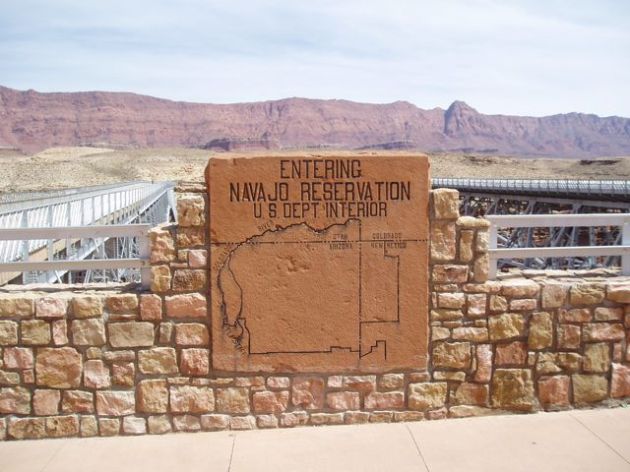
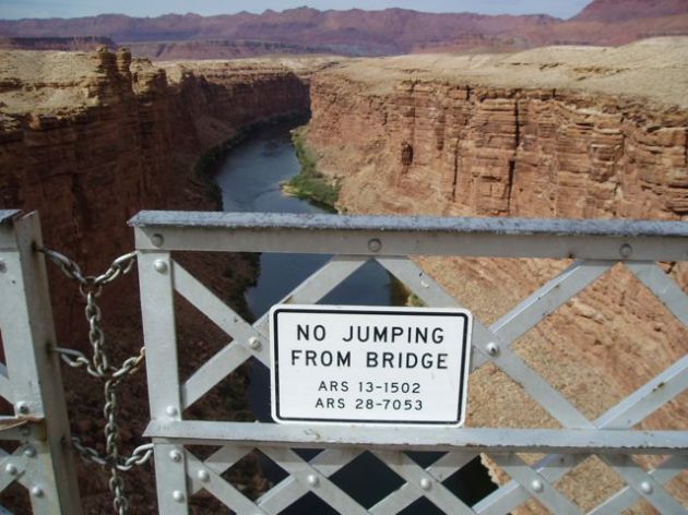
I always stop at Navajo bridge over Marble Canyon of the Colorado River to stretch my legs and look down. The river serves as the western boundary of the Navajo Nation in this area.

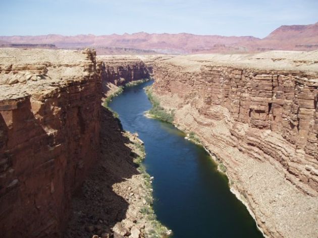
The river flow is regulated through Marble Canyon by Glen Canyon dam. That means, the river flow is about the same on most days, and one can no longer see the variation in flows depending upon the season. The trees along the river banks are invasive Tamarisk trees, a noxious plant that is rapidly spreading throughout the Colorado River system.

Looking north toward Kanab, Utah, the land is flat and desolate, but a staircase of steep cliffs occupies the horizon.
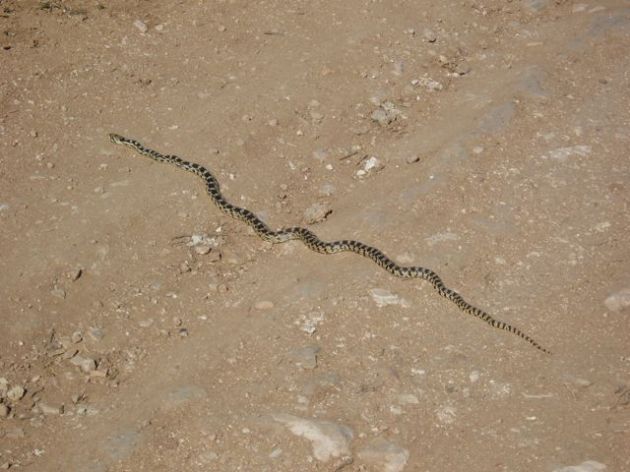
The land isn’t completely lonely, I see dozens of these snakes every time I am in Utah. They tend to lay across rural roadways late in the day, and one must have good eyes to avoid them. I call them “black and tan” snakes because I don’t know what kind they are.

I consider Kanab, Utah a poor man’s Sedona (Arizona). It has the natural beauty, the red rocks, and spiritual presence, with smaller crowds, less commercialism, and less social interference. In Sedona, someone will sell you a spiritual connection to the Earth. In Kanab, you have to go out and find it.

There’s a small intermittent stream flowing through Kanab, appropriately named “Kanab Creek.” Entrenched in an arroyo about 150 feet deep, the creek really doesn’t flow through town, but below town.


Most of the town lies on gently-sloping ground. But as you can see, the road has to traverse a steep gradient in order to cross the creek.


Sandy sediment forms the walls of the arroyo, and many buried soil horizons are visible.


Also visible are these root casts, where the voids from old roots were filled by calcium carbonate, fine sediment, and other minerals.

Soil horizons take a long time to develop – hundreds to thousands of years. The buried soil horizons in the sediment along Kanab Creek indicate the creek was depositing sediment over a period of thousands of years. Some time later, the creek eroded through the sediment creating the arroyo. This erosional process probably occurred with just a few big floods over a span of just a few decades. Those are typical timescales in the geomorphic world, sediment accumulates over thousands of years, but erosion of gullies happens in just a few catastrophic events.

Also along my route was Coral Pink Sand Dunes State Park (Utah). It’s just north of the Arizona border and Northwest of Kanab, and very close to where I was doing work.

Sandstone composes most of the cliffs in the area. When the sandstone weathers and breaks down, it reverts back into sand. West and southwest winds blow constantly over the Colorado Plateau in the spring, funneling through a gap in the cliffs where the sand accumulates, forming the dunes. The wind blows the sand, and this happens to be the area where the sand gets trapped, similar to how a ceiling fan causes dust and pet hair to accumulate in the corners of a room.

The wind also exposes the underlying sandstone in swales between dunes, demonstrating how the wind is constantly moving the sand and reshaping the dunes.


Dunes are constantly changing landforms. Wind is constantly reworking the sand into new shapes. My boot print was only a few seconds old when I took the photo, and was completely obliterated within just a few minutes.


